
Are you ready? Hurricane preparation starts weeks before first storm of season
CLAY COUNTY – No matter how evolved science gets, experts often struggle to know when, and where, a hurricane will form. And since they’re driven by water temperature, currents, upper winds and …
This item is available in full to subscribers.
Attention subscribers
To continue reading, you will need to either log in to your subscriber account, or purchase a new subscription.
If you are a current print subscriber, you can set up a free website account and connect your subscription to it by clicking here.
If you are a digital subscriber with an active, online-only subscription then you already have an account here. Just reset your password if you've not yet logged in to your account on this new site.
Otherwise, click here to view your options for subscribing.
Please log in to continueDon't have an ID?Print subscribersIf you're a print subscriber, but do not yet have an online account, click here to create one. Non-subscribersClick here to see your options for subscribing. Single day passYou also have the option of purchasing 24 hours of access, for $1.00. Click here to purchase a single day pass. |
Are you ready? Hurricane preparation starts weeks before first storm of season


CLAY COUNTY – No matter how evolved science gets, experts often struggle to know when, and where, a hurricane will form. And since they’re driven by water temperature, currents, upper winds and other meteorological forces, they best forecasts often wind up being hundreds of miles off the projected target.
That’s why Clay County Emergency Management Director John Ward doesn’t study numbers when he’s getting ready for another hurricane season.
“We've heard so far it's going to be 19 named storms, you know, 10 hurricanes for major,” Ward said. “The busiest season we've ever had on record was two years ago and Florida didn't get touched. One of the slowest seasons we have ever had was in 1992 with Hurricane Andrew. Tell South Florida it was a slow season.
“It only takes one the impact your community, so I don't play those numbers.”
He also doesn’t want residents to be unprepared. As hurricane season approaches on June 1, Ward said the first step is to sign up at Alert.claycountygov.com to get thunderstorms, tornado, flooding and hurricane alerts. The message system also provides important information about what to expect, where to go and when to take protective measures.
Another tool is downloading the SaferWatch app to get updates on traffic and other law enforcement-based information.
After that, stay tuned.
“We're out really trying to push that message because now's the time to prepare,” Ward said. “Because I can tell you, the one thing you will generally see is when there's a storm that's going to be threatening our area, everybody's running to get gas and everybody's running to the grocery store. You're not going to have your stuff, so make that plan now so you're not having to rush around. That 50-hour mark is, literally, the last minute that you've got to make that decision to do it or not.”
Colorado State University is considered one of the leading experts on tropical cyclones. The university is projecting “an above-average” season with nine storms – four of them being major – making landfall. A year ago, CSU said the Gulf Coast would be a hotspot, and the university was proven to be on point with Hurricane Ida and Tropical Storms Mindy, Claudette and Danny all making landfalls between Louisiana and the Florida Panhandle.
The Gulf is expected to be a point of concern this year, too, but the focus is expected to shift toward Central Florida. The CSU staff also said this year’s hurricane rate will be 130% compared to normal years.
“Colorado State University generally puts out the first forecast and then they'll do an updated forecast in like June or July, but they're getting more in-depth now,” Ward said. “Essentially, they will just get some numbers and then they adjust. It's just like any forecaster: you can be wrong 50% of the time and still have a job, but they're getting to where they're identifying areas that they think are gonna be the hotspots now more so than just numbers awesome.”
Colorado State said the absence of El Niño is one reason for the “above average” hurricane forecast. El Niño forms in the Pacific Ocean, and its wind shear force can rip apart hurricanes as they form in the Gulf and Atlantic.
There were 21 named storms last year, but none affected the First Coast.
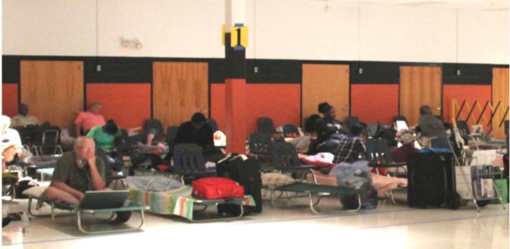
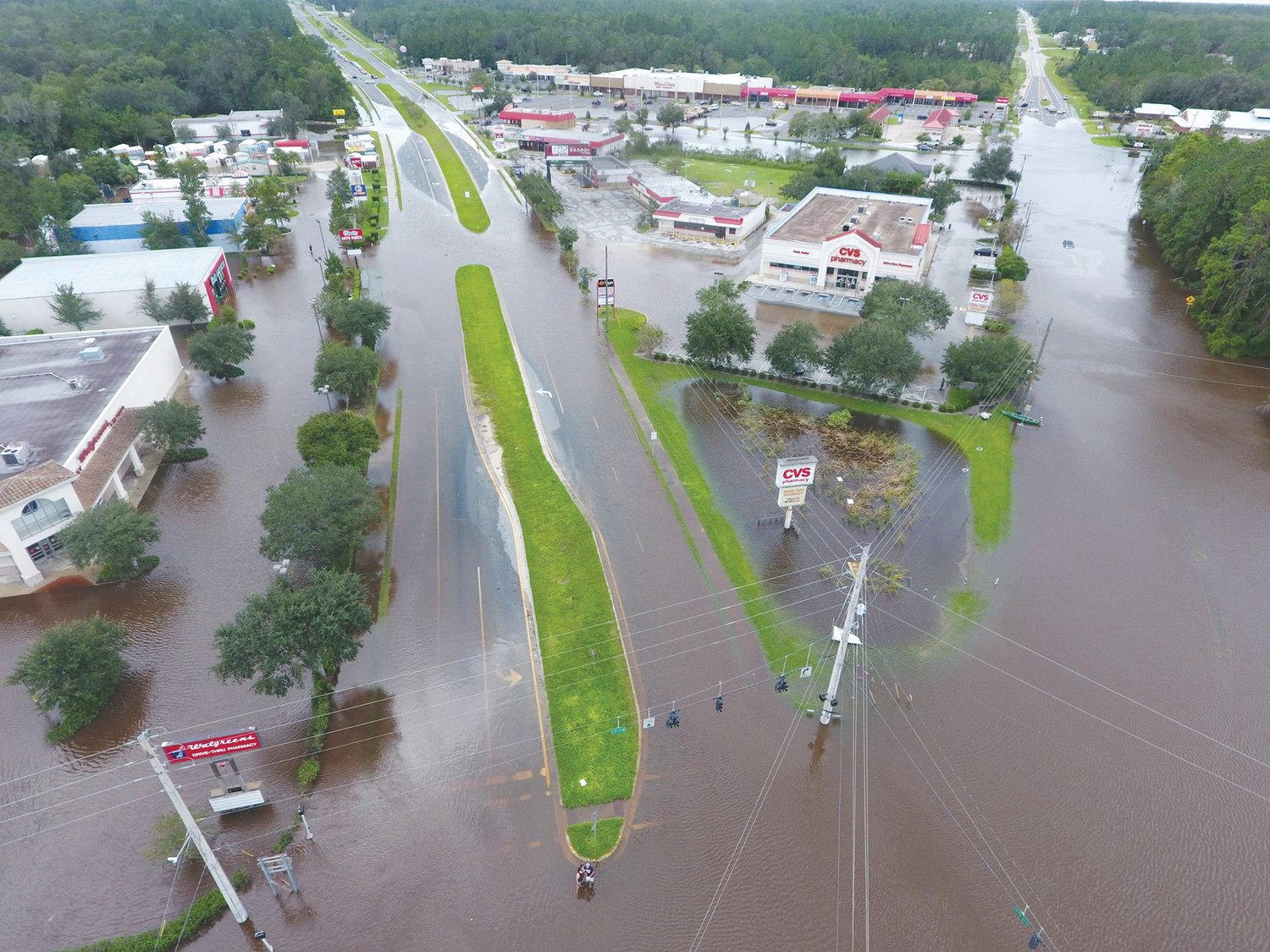
As the county’s population continues to grow at a record rate, Ward is concerned residents may not understand the power of a major storm.
“You know, we've got a lot of new folks in the community,” he said. “Have they ever experienced a storm? You know, people think because we're inland that we don't have anything to worry about. Literally, all you saw all the way up into Georgia and (Hurricane) Michael (in 2018) was still a Category 3 storm over 100 miles inland.”
Ward said Clay County hasn’t had any sustained winds from a hurricane or tropical storm since Hurricane Dora in 1964.
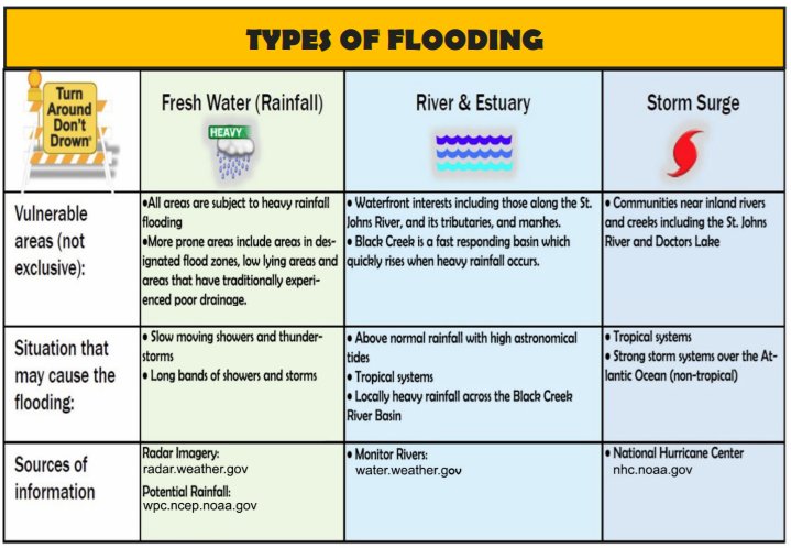
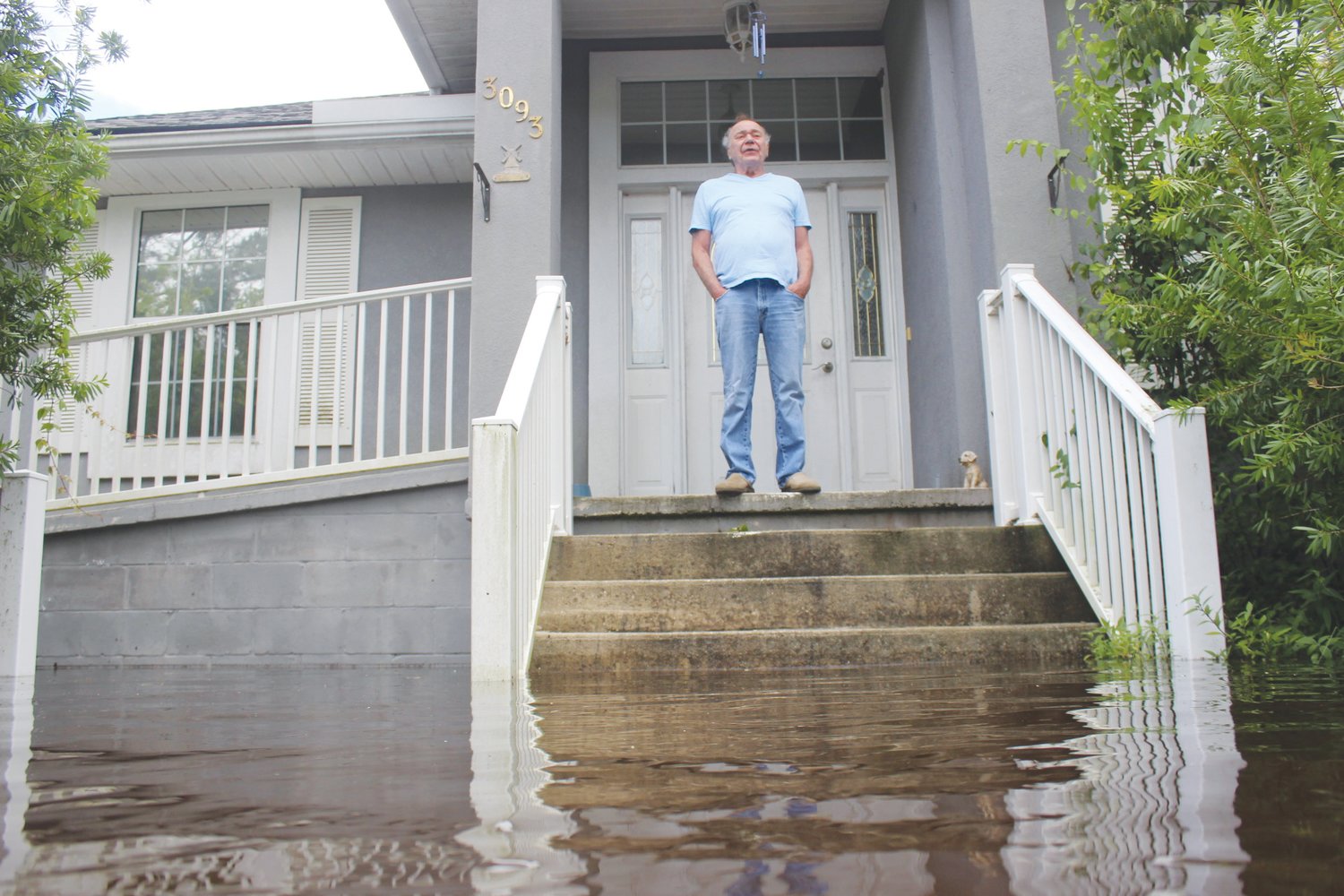
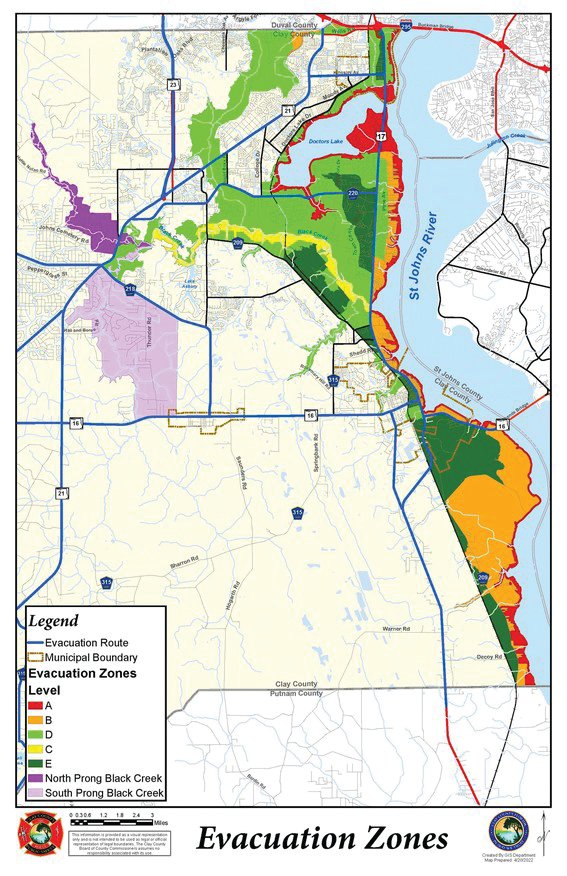
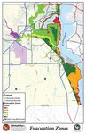
To keep up with growth, the Northeast Florida Sea, Land and Overland Surges from Hurricanes model results were released by the National Hurricane Center in late 2021. The new Storm Surge Basin takes advantage of faster computing power to cover a more comprehensive area and provide a more inclusive picture of storm surge inundation into Clay County.
The information, in combination with historical impacts and existing flood zones, is the basis for the new evacuation zone map. Residents who were previously not in an evacuation zone may now be included due to this updated storm surge data.
The new map can be found at claycountygov.com.
“In a nutshell, people should stay informed,” Ward said. “Stay informed and pay close attention to your local media. If you do social media, monitor your government and your emergency management. There's a lot of misinformation that tends to get out and we’re really trying to control that.”
Ward said to rely on the National Weather Service and the National Oceanic and Atmospheric Administration’s National Hurricane Center for the most poignant information.
![]()
get social