
Emergency Management to keep an eye on hurricane season
Storm plans change as development reshapes the county
Emergency Management to keep an eye on hurricane season
Storm plans change as development reshapes the county
By Don Coble
don@claytodayonline.com
GREEN COVE SPRINGS – The routine …
This item is available in full to subscribers.
Attention subscribers
To continue reading, you will need to either log in to your subscriber account, below, or purchase a new subscription.
Please log in to continueDon't have an ID?Print subscribersIf you're a print subscriber, but do not yet have an online account, click here to create one. Non-subscribersClick here to see your options for subscribing. Single day passYou also have the option of purchasing 24 hours of access, for $1.00. Click here to purchase a single day pass. |
Emergency Management to keep an eye on hurricane season
Storm plans change as development reshapes the county


GREEN COVE SPRINGS – The routine rarely changes for Mike Ladd, especially when the calendar turns to June.
The acting emergency management director for Clay County is never far from his two cellphones, where he jockeys between emails and the weather service. He knows Florida has little time to react when the tropics are unsettled.
As the landscape changes with development and progress, the methods of dealing with Mother Nature’s wrath also change.
“The bigger concern is, typically, that we’re very susceptible to wind and surge,” he said. “So whether big or small, it’s more effects-based. I think that, unfortunately, a lot of folks get trapped into the Saffir-Simpson Scale, Cat 1, Cat 2, Cat 3, whatever. The effects of the smaller storms, we still had significant flooding with significant surges and downed trees. The wind may not have been as long-lasting, but they’re still there for those periods of intensity.”
Emergency management offices also face the challenge of ensuring the community is safe and prepared, even if previous alerts aren’t as disastrous as feared.
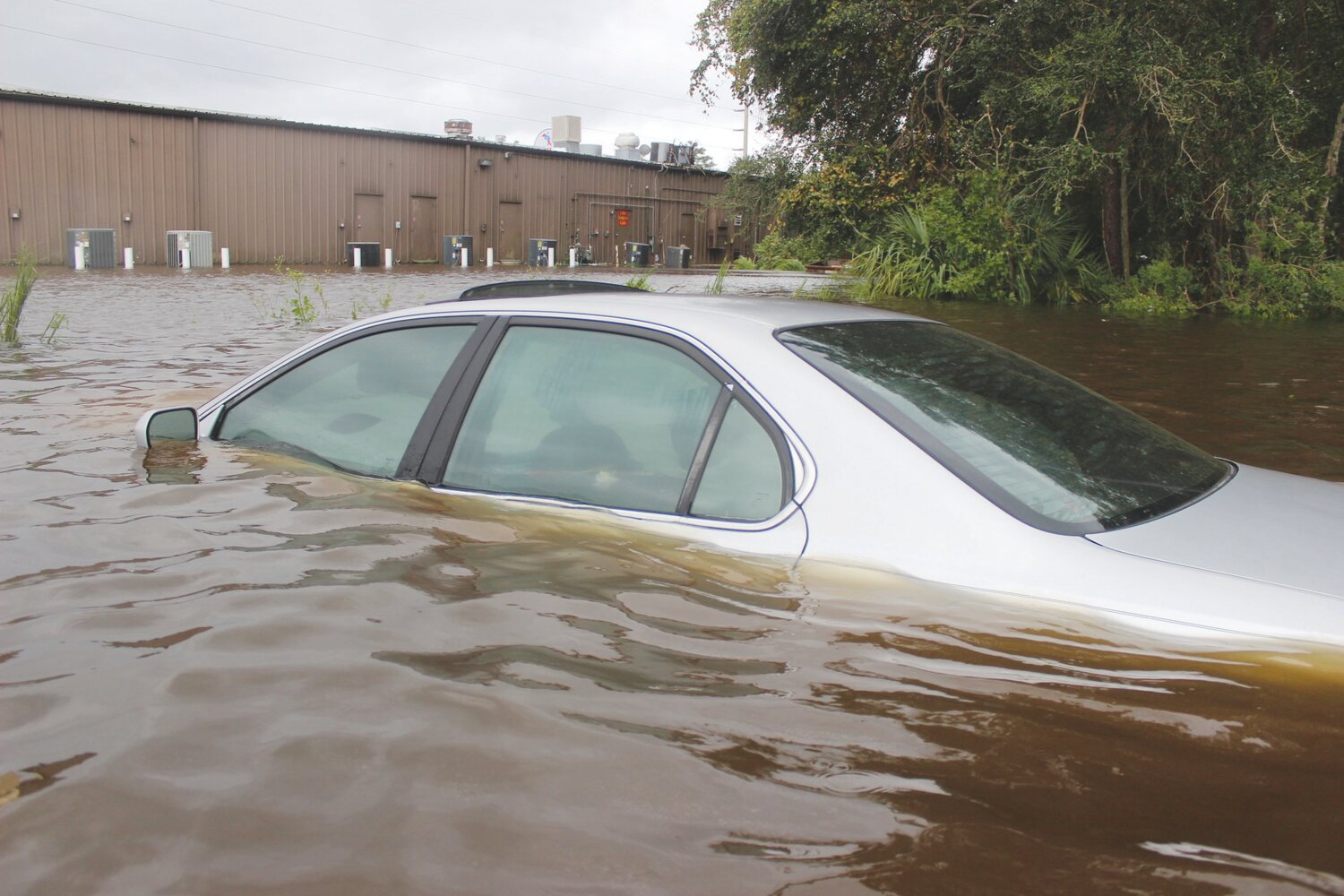
The last two tropical-related storms to hit Clay County were Ian and Nicole. Both caused minor flooding, erosion and wind damage.
Ian was spawned from a Tropical Wave off the coast of Western Africa last October to a Category 5 storm with 160 mph winds. It was projected to hit the Florida Panhandle but took an unexpected turn to the East and tore through Fort Myers and surrounding areas.
The unpredictability of the storm prompted Clay officials to order an evacuation. Again, Ian fooled experts and left the state along the Space Coast. It turned again and hit South Carolina.
But Clay essentially was spared from any significant damage.
“You have a complex problem where you’re trying to make sure (to make accurate plans),” Ladd said. “We’ve luckily. We have a very good team that’s been here, done that. They do this all the time. I mean, there’s no new curveballs.”
Ladd said the first step to being prepared for all dangerous weather is downloading the free Alert Clay app from the claycountygov.com website. It will inform residents about hurricanes, thunderstorms, evacuation notices and flood warnings.
“That is our information conduit,” Ladd said. “We really just need to pound the table so folks can get our information content. Its got packing lists and preparedness guides and all that good stuff.”
As development turns wooded areas and wetlands into housing developments, Ladd said the landscape change presents an ever-changing challenge.
“It’s more geographic based and more of the susceptibility to wind and storm surge,” he said. “As we have more development and again, I don’t have a lot of blueprints, and I’m not an architect by any stretch, but as that topography starts to change, then some of the models of the (Black Creek) South and North prongs could adjust waterways. Some places that may not have flooded in the past may flood this time.
“What concerns me is any changes to what I think to be a somewhat sedimentary problem set. If there are changes in the topography, the big thing is, will the problems act differently than I think they’re going to?”
The last official Tropical Storm here was Andrea in 2013. It had a maximum sustained wind of 55 mph. The last hurricane came in 2006 with Ernesto. The most-powerful storm was Georges in 1998, with top winds of 135 mph.
The costliest, however, was Irma in 2017. It ripped across the state before being downgraded from a Category 5 to a strong Tropical Storm with maximum winds of 72 mph.
Irma, however, was a significant rain event, dumping 14 inches of water in a county already defined by its waterways. Flooding destroyed or damaged 858 homes and forced the evacuation of 900 residents. Water levels for Black Creek’s North and South prongs measured at 28.5 feet – nearly three higher than the previous records.
A record 6.5 million people were evacuated during Irma – the largest in state history. From the Caribbean to Southeastern U.S., a total of 134 people died, and it caused $77.2 billion in damages. In Clay, nobody died, but it left more than $40 million swath of local damage.
![]()
get social