
Ian’s unexpected turn takes Clay County out of its wrath
Emergency management warns against being flippant about future storms
CLAY COUNTY – Residents brought in plants and outdoor furniture and trimmed trees. They fortified their homes with sandbags and stocked up on bottled water, diapers, gasoline and bread.
Shelters …
This item is available in full to subscribers.
Attention subscribers
To continue reading, you will need to either log in to your subscriber account, below, or purchase a new subscription.
Please log in to continueDon't have an ID?Print subscribersIf you're a print subscriber, but do not yet have an online account, click here to create one. Non-subscribersClick here to see your options for subscribing. Single day passYou also have the option of purchasing 24 hours of access, for $1.00. Click here to purchase a single day pass. |
Ian’s unexpected turn takes Clay County out of its wrath
Emergency management warns against being flippant about future storms


CLAY COUNTY – Residents brought in plants and outdoor furniture and trimmed trees. They fortified their homes with sandbags and stocked up on bottled water, diapers, gasoline and bread.
Shelters were opened and evacuations were ordered.
And just as Clay County dug in on Sept. 29 for what was supposed to be significant damage from Hurricane Ian, the massive storm made an immediate – and unexpected – hard turn to the left and passed to the south.
Ian didn’t follow any of the projected paths from the experts, proving again Mother Nature doesn’t pay attention to forecasts or expectations.
Clay County Director of Emergency Management John Ward was relieved the area was spared the brunt of a storm that rolled over and through Fort Myers as a Category 4 storm on Sept. 28.
Now comes the challenge the reassure residents not to be dismissive of the next storm.
“Obviously, we had to change and pivot,” Ward said. “We have to be Super Gumby and always flexible. Last week was a perfect example. We ordered evacuations and opened shelters. I always tried to wait till I'm sure on that. Like I've said before, I've got about 23 hours that I've got to do it to execute to be effective. I was actually well inside that. I should have done it earlier but there was so much changing information that I was unsure.
“Literally before the press conference, called the hurricane center and the National Weather Service and said I'm hesitant about what I'm getting ready to do. I wasn’t comfortable. I didn't see it. Of course, they're the experts. They tell me we're going to get tropical storm force winds and 15 inches of rain. I gotta go by them because they're the experts in there who we go by and go to court with at the end of the day.”
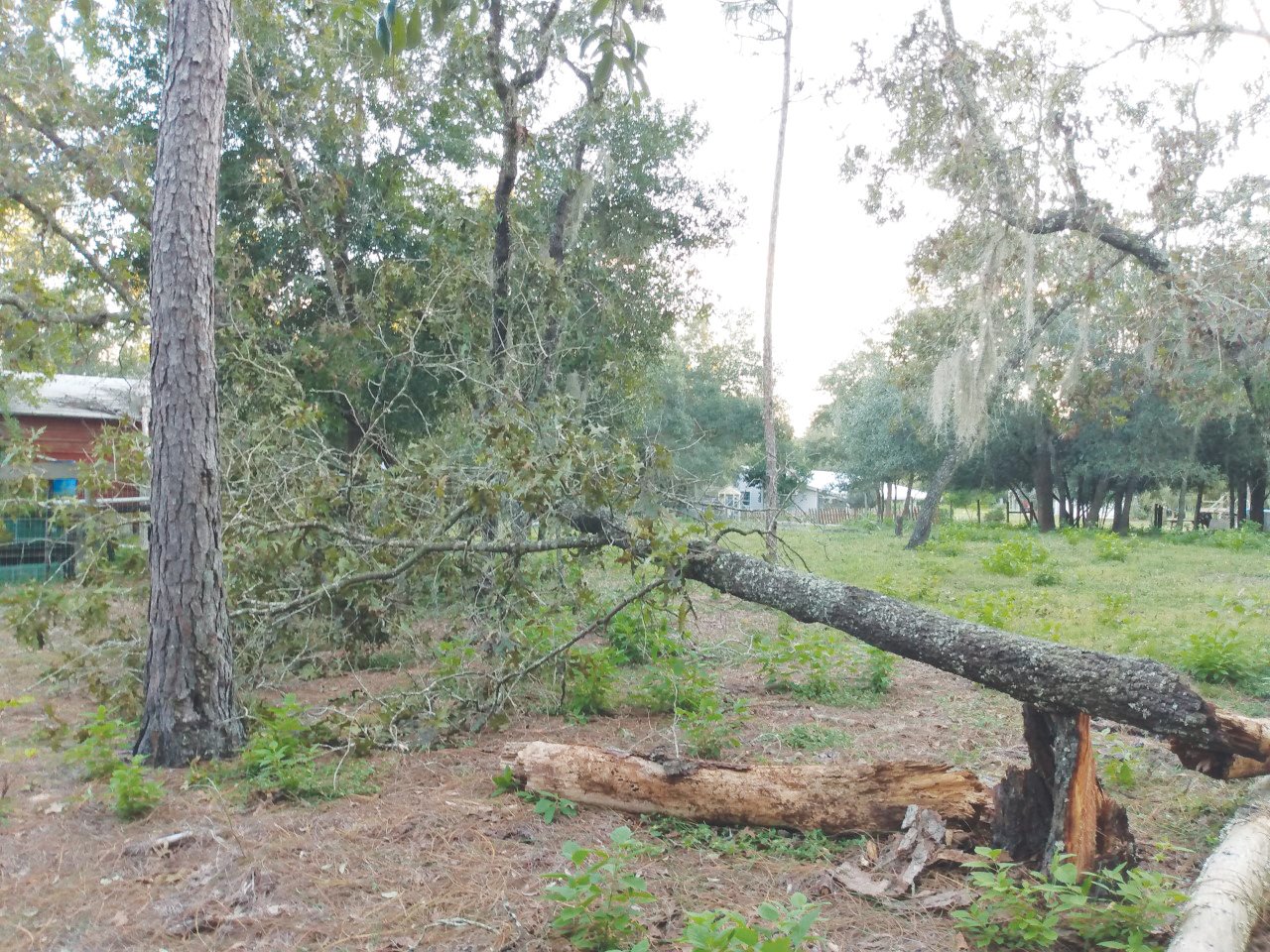
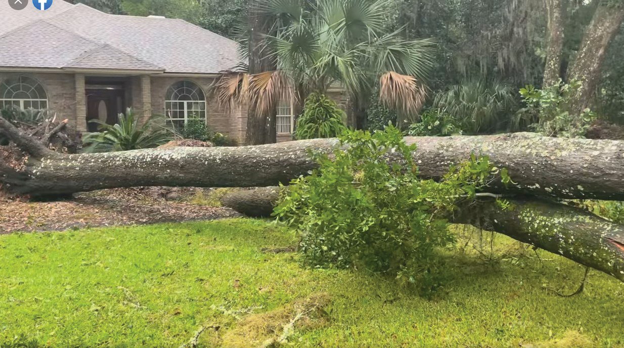
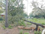
There were a few downed trees reported in the county and minor flooding near Doctors Inlet and Black Creek.
Keystone Heights prepared for the worse and prayed for the best. The rural area was a primary concern since many of the homes there are older and some of the infrastructures are lacking.
“It’s a weeklong preparation for the potential of a really bad storm and we are very grateful that it wasn’t a really bad storm, but we were ready if it would have been,” City Manager Lynn Rutkowski said.
Keystone Heights High School was available for residents to take shelter and Clay County Animal Services provided animal shelter in the high school for pet owners while they stayed at the shelter.
The Clay County Schools District said all 52 schools were inspected and reopened for classes on Oct. 3.
Southwest Florida wasn’t as lucky. Fort Myers and its barrier islands had less than a two-day warning. Everyone expected Ian to make landfall near Tampa, but it fooled everyone with a stunning turn 125 miles south of the bay area.
“I asked (National Weather Service and hurricane center) if it was going to move or take us out,” Ward asked. “They said no. These are your impacts. Two hours later, it shifted.”
Ward said he doesn’t regret deciding to tell the community to hunker down.
“I'd rather be on the safe side,” he said. “But my problem is when I issue those evacuation orders, it's almost like crying wolf. How many times do you cry wolf before the citizens don't listen anymore? That's my biggest concern.”
Ward said others were stunned by its unpredictability of Ian. Action News meteorologist Mike Buresh talked with Ward before and after the storm. Ward also talked with a friend who is about to retire after 40 years with the National Weather Service. He said neither had witnessed a storm like Ian.
“Mike (Buresh) said Clay County was literally 30 miles from some of the worst weather (in St. Augustine),” Ward said. “I'll take any criticism there is, but you got to make the decisions that you have based on the information you have at the time.”
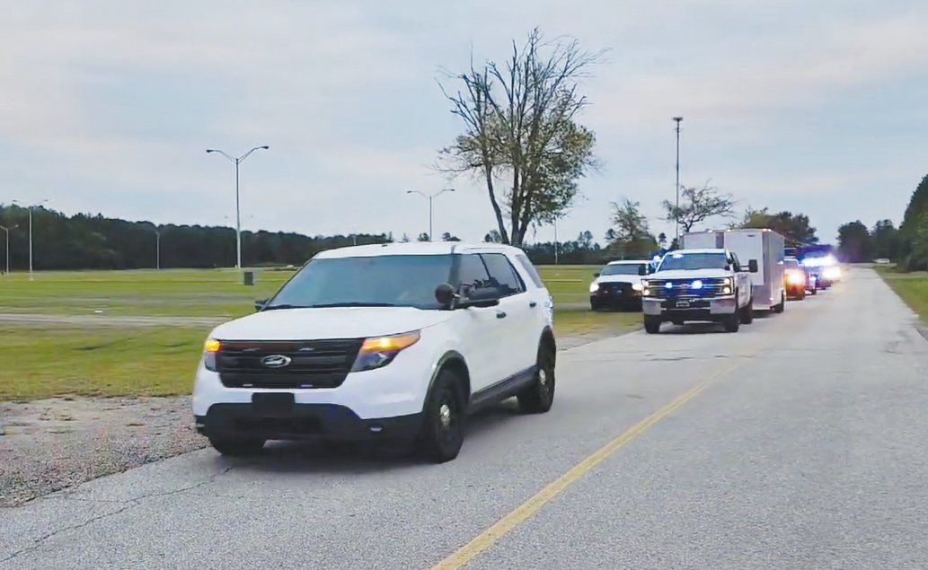
Along with a contingent of deputies from the Clay County Sheriff’s Office, Ward joined the rescue effort in the Fort Myers area. A second group from the county’s emergency management team was deployed to Osceola County.
At the same time, he will maintain his vigil of watching the tropics for the possibility of another storm.
Natalie Gilstrap contributed to this report.
![]()
get social